A 100k Cycling Trip
Published on
Tags: cycling, fitness, openstreetmap
A 100km cycling trip was overdue, especially after I've been running a lot. A few months ago, I did a duathlon of 10k run followed by a discontinuous 50k cycling trip. Also after that I did a 62km cycling trip with a friend and I knew that I was fit and ready for a 100k cycling trip. But still, lack of time impeded me as a 100k trip would take an entire day. Also I was waiting for the scorching summer to end - during afternoon, the extreme heat reaches dangerous levels of upto 45°C heat with 40% humidity, which results in a heat index of more than 54°C, which is in the extreme danger zone as defined by NOAA. Now with winter, the temperatures reach a maximum of 35°C, which is pleasant.
So, at latter half of November on a sunday, I went on a trip. On the previous day, I got my btwin rockrider 340 bicycle and other supplies ready - 3 liters of water(one liter was electrolyte solution), repair kit, air pump, helmet, rain coat and some bananas. I made a rough plan on places go - I selected three towns to make a rectangular path around my college using OpenStreetMaps, which would make me cover 100km.
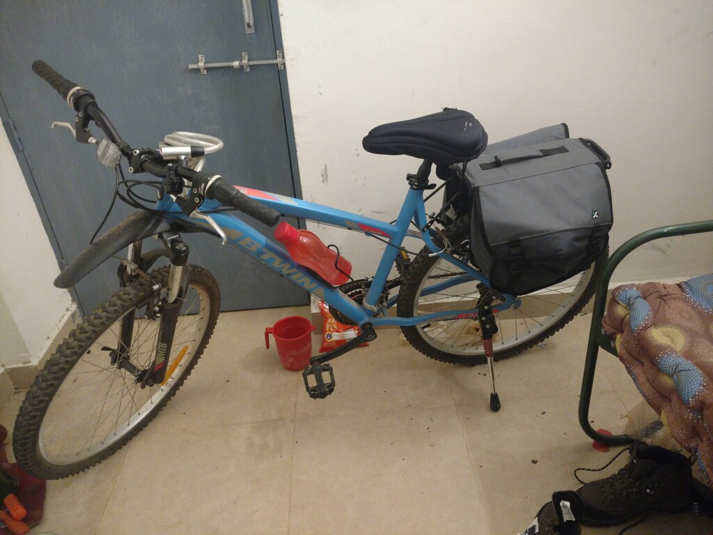
Figure 1: Ready for action!
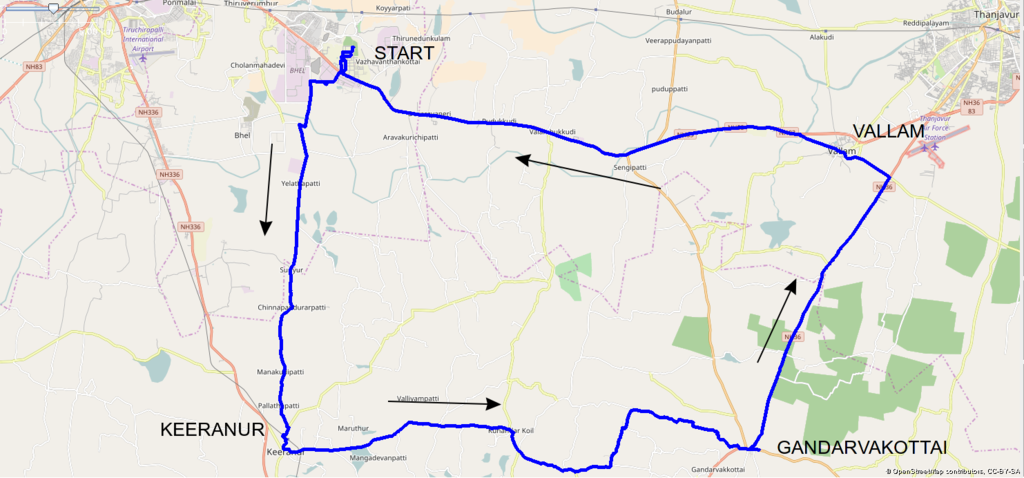
Figure 2: Route taken by me
I planned to start out at 6am in the morning, but started out at 7.30am due to a bit of procrastination. I had my breakfast at 7am in my hostel mess. First I navigated out of my college campus and then headed for Keeranur, a small town. It was bout 25km south. I had initially planned to go the side of a pond which I saw in mapbox, but the road to the pond was non-existent and I didn't want to take risk of a tyre puncture and spoil my trip. I stuck along the small highway to Keeranur. It was morning and the weather was rather cold. Hence I wore two T-shirts, one over the other to reduce the impact. It worked well and the breeze felt pleasant instead of biting cold. The road to this town some greenery which was mostly shrubs and some trees struggling to exist in a dry year. There were several small villages, marked by sign boards and I paused and noted down each one of them in the OpenStreetMaps application - osmand~ for mapping and contributing to OpenStreetMap's database. The wind was on my back as it was the North East Monsoon season. I could go in the topmost gear most of the time, reaching speeds of 25kph (30kph possible, but that would tire me out). I reached Keeranur in about 2 hours. It was a fairly small town. I witnessed a minor incident involving a juvenile dog - it was crossing the road, but then came a speeding taxi. The dog probably got confused and didn't react in time. The taxi came to a screeching halt near the dog and fortunately it ended up below the car in the middle instead of the tires. Yelping in fear, it ran away, probably with a bruise or two. I took a small break by sitting in a bus shelter near an government administration building and ate some of the bananas that I had brought. Unfortunately, I hadn't packed my bags well, and hence some of the bananas had been squashed and had become inedible.
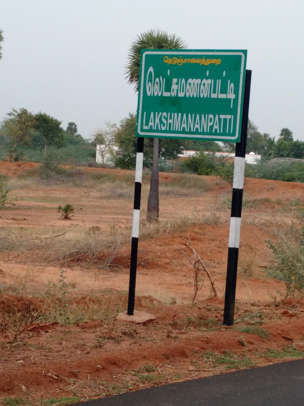
Figure 3: A board indicating a village name
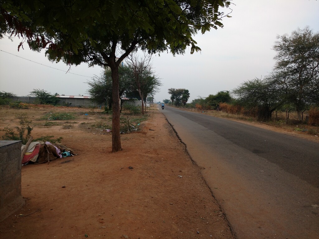
Figure 4: A random shot along road to Keeranur.
After Keeranur, I continued eastward to Gandarvakottai. The road along the way was somewhat less populated compared to the previous one. There were many villages, but about one km or more away from the road. The day was getting a bit warmer and I stopped in an abandoned bus shelter to remove my inner T-shirt. This road had more greenery compared to the previous one. There were many banyan trees in particular. One of the places looked heavenly with tall banyan trees with their roots cropped by passing vehicles and I took a photo of that(below). In one particular place, there was a herd of goats passing being herded by its owner and her dog. I slowed down to navigate through the herd. The dog barked at me(which I hated), but didn't try to attack. I encountered cows as well. In this road, I couldn't go in the top gear, as the wine from the north east direction was against me. Also, was getting a little tired. Then along the way, I saw something which I had never seen before - a flowering cactus! I stopped to have a look at the flower and took some photos. I then continued on my way to Gandarvarkottai. I passed through a few cultivated farms and a few villages. Children would point at my bicycle and say - 'Hey look at that! That's a gear cycle'. I reached Gandarvakottai after about 3-4 hours of travel. It was a fairly large town with a large marketplace. I searched for a suitable restaurant to have lunch. But there wasn't any lavish restaurant and I ended up choosing a small cafe instead. This particular cafe didn't have much customers. In fact, it was empty when I arrived. There was no kitchen either and all the food there seems to have been bought from elsewhere. I ordered a dish of 'veg meals' - which in South India would be a standard diet of rice with a vegetable curry and side dish of vegetables, served in a banana leaf. I usually eat less rice compared to others and the cafe owner noticed this and commented that children today do not have strength because they don't eat well. I didn't want to point to him that I was quite a fit person and that I had just traveled 60km to reach his shop. The food was fairly good.
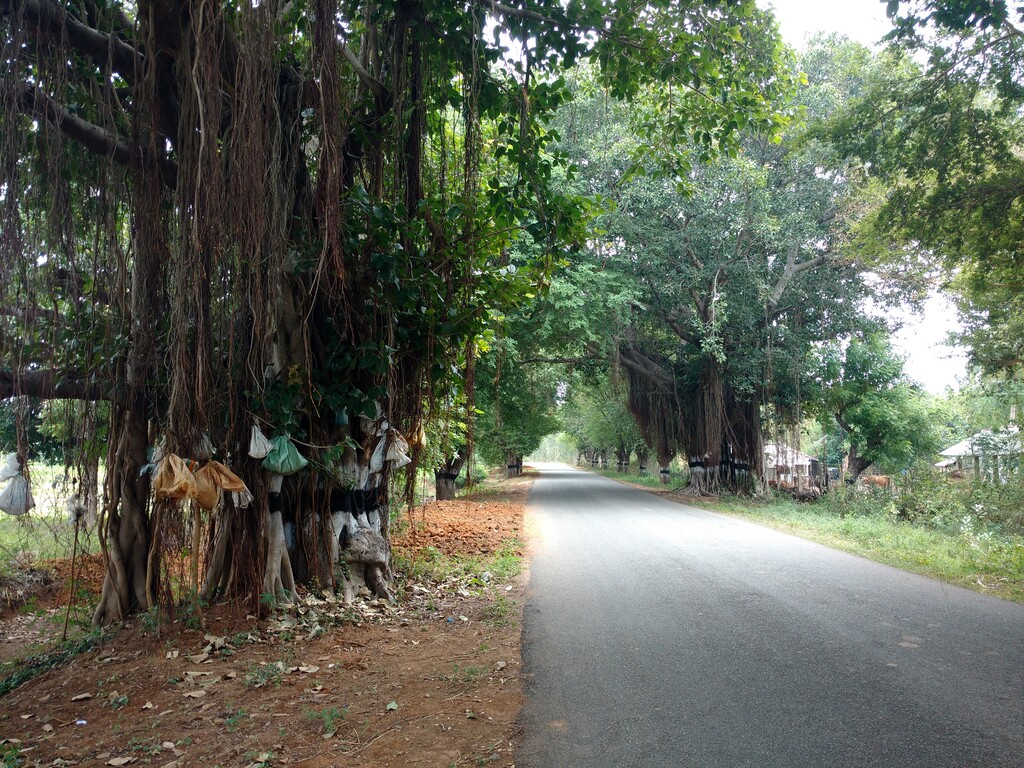
Figure 5: Banyan Trees
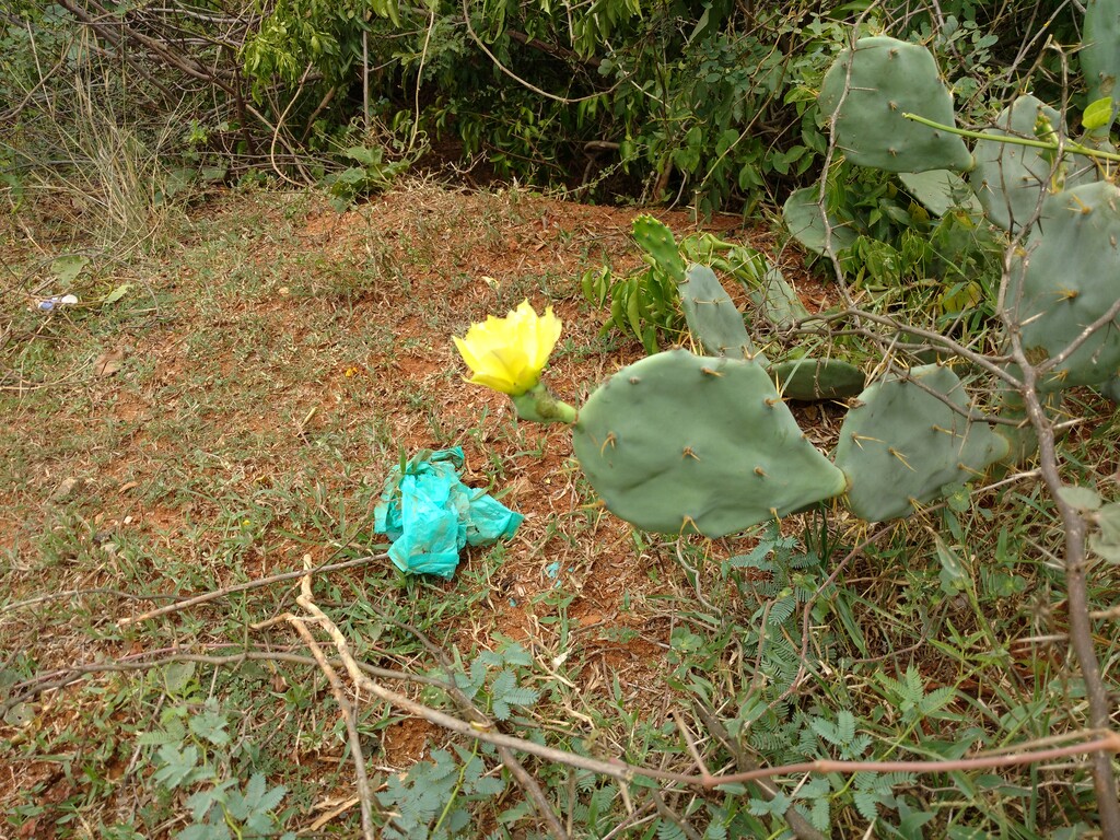
Figure 6: Flowering Cactus
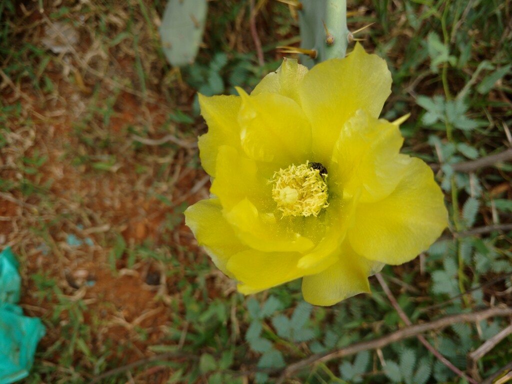
Figure 7: Bee in flower
After lunch, I started towards Vallam, which was about 20km away. The road was a newly built 2 way road, but very wide compared to the previous ones. Since this route was in a north east direction, I was now traveling in an almost complete opposition to the north east monsoon wind. Also the lack of vegetation along this road meant that there was nothing to impede the wind. I had to drop down to lower gears combination of 2,4 in my 3x7 gear system. My speed was quite low and it rarely exceeded 10kph. My osmand~ app showed that I was slowly gaining altitude too. But what really made it hard was that I couldn't curb my urge to go faster and hence I tried too hard and got quite exhaused. This made me pause along the road several times. When pausing I sat on walls of small aqueducts, which drained into some kind of hole with gravel (shown below). This was present along the entire length of this particular road. There were a few farms along the way too, cultivating corn and some cassava like crops which I believe to tapioca. Some of the corn fields were harvesting too and they had laid the corn along the side of the road (I don't know for what). The black tar road contrasted nicely with the orange-yellow color of corn. There an unpleasant sight of burning plastic as well. The road became a little more easier after about 5km when I got used to traveling at a slower pace and when the began to lose altitude. I was able to travel a little faster, slightly above 10kph. I reached Vallam after about 2 hours of travel, but I had to navigate through the town to reach the Trichy-Thanjavur highway to travel back to my college.
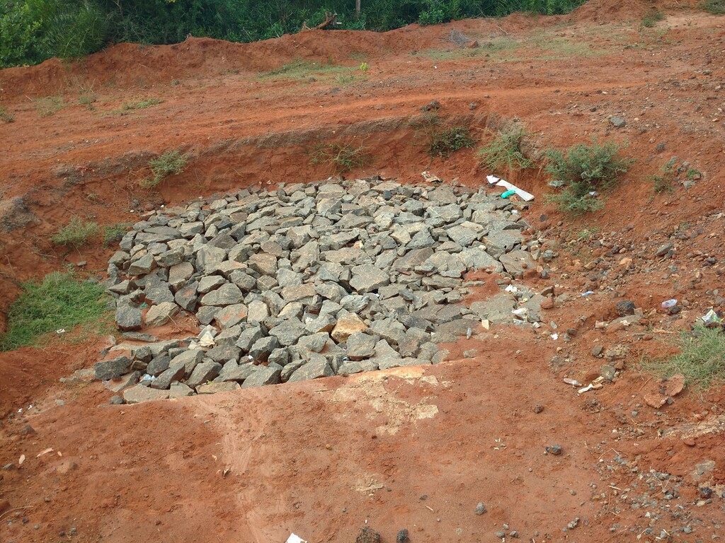
Figure 8: Some kind of drain
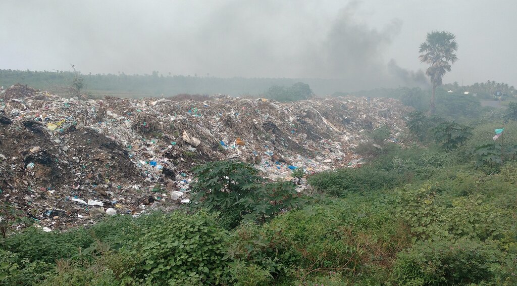
Figure 9: Burning plastic
When navigating through the town from the south, I traveled through a road marked as tertiary highway in OpenStreetMaps. But I found that the road was primarily residential in nature with people using it as some sort of shortcut (or I assume it so) to the main Trichy Tanjore Highway. I made a note in osmand to change the road type later. When I reached the Trichy Tanjore highway, I found a restaurant and decided to have some snack there. I met an person who had managed the shop in my campus long back and had a little chat. He was the restaurant waiter/cook there. After having some snack, I continued along the Trichy Tanjore highway. Now that I was traveling West, the North East monsoon winds was on my back and I was able to travel in high gears. I saw an establishment type that I had never seen before - a wayside motel with rooms for overnight stay. Usually the motels here are just restaurants along the highway which the long distance travelers stop. It was 6pm now and getting dark. Hence I turned on the safety lights in my bicycle (front and rear). I continued along the highway and crossed many buildings and features that I had already covered in my earlier trips. Along the way, I crossed the 100km mark. I reached my college at 6:40pm and finally completed my first ever 100km trip! I was quite exhausted, but happy to have completed another one of my goals in 2016. My final distance was 113km in 11 hours. osmand says that I was active close to 8 hours.
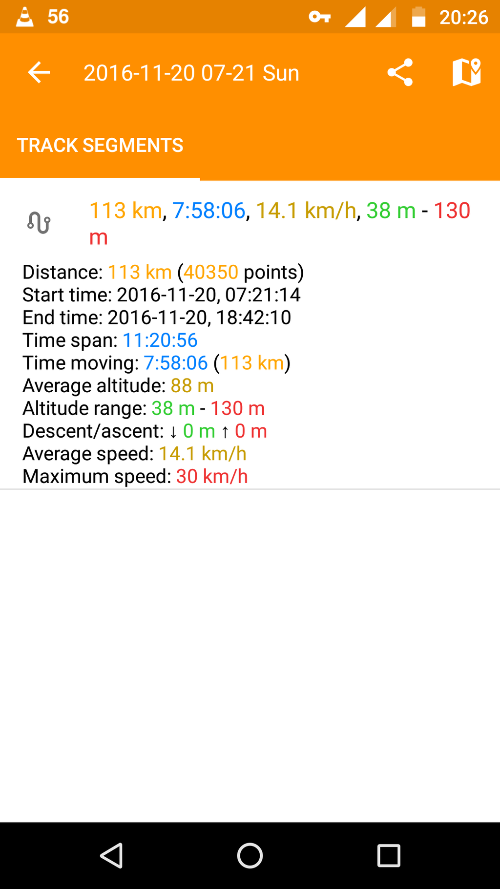
Figure 10: Cycling Stats
